The drives between Santa Fe and Taos are frequently counted among Travel + Leisure’s best (see: America’s Best Winter Drives, America’s Most Scenic Roads and America’s Best Spring Drives). High Road Southern Terminus: Junction of U.S. 285/84 and State Road 503 in Pojoaque Northern Terminus: Junction of State Road 518 and State Road 68 in Ranchos de Taos Driving distance: 56 miles.
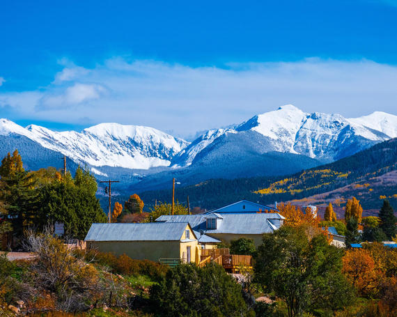
The “High Road” to Taos brings travelers through high desert, forests, and mountain countryside as it winds through the Sangre de Cristo mountains of Northern New Mexico. This route passes through more than a dozen small communities nestled in the hills, each with its own rich history. The Nambe and Picuris Pueblos, the ancient community of Talpa date back hundreds of years, while Chimayo, home to the famed Santuario de Chimayo, Cordova, and Las Trampas are home to artisans who practice traditional and modern crafts. Las Trampas is home to the San Jose de Gracia Church, which is a National Historic Landmark and considered a model of Spanish Colonial Church Architecture. The symbolic northern terminus is the iconic San Francisco de Asis Mission Church, in Ranchos de Taos, one of the most painted and photographed churches in the country.
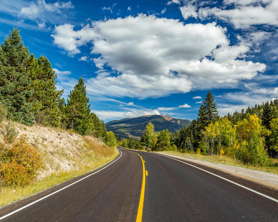
This 84-mile loop connecting Taos, Eagle Nest and Angel Fire shows off some of Northern New Mexico’s iconic sights and landscapes.
The route circles Wheeler Peak, which at 13,161 feet in elevation is New Mexico’s tallest peak. Wildlife including elk, black bears and eagles can also be seen from the roadway. The fiery spectrum of golds, oranges and reds of aspen and cottonwood trees in fall help put it on Travel + Leisure’s list of America’s Best Fall Foliage Drives.
The route follows U.S. Route 64 between Taos and the small community of Eagle Nest and turns onto NM 434 to the community and popular resort area of Angel Fire. Between Eagle Nest, the resort community of Red River and Questa, the route follows NM 38 before following NM 522 between Questa and Taos.
Drivers can travel between Albuquerque and Santa Fe by two main routes: Interstate 25 and State Road 14. Though I-25 (the more efficient route) passes through several pueblos and features views of valleys and mesas, NM-14 wins the contest for the scenic route. The road makes up most of the Turquoise Trail, a National Scenic Byway, and passes several points with breathtaking views.
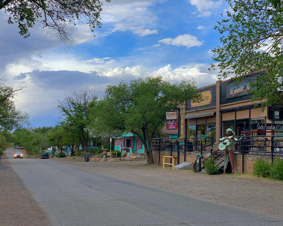
The Turquoise Trail is a road for drivers who like winding over mountains and through valleys. The road passes rugged and undeveloped mountains between San Antonito, toward the south, and Cerrillos (a small community once a bustling mining town) allowing for expansive views of the plateau outside Santa Fe and the Sangre de Cristo Mountains. Mountainsides and mesas present brown, yellow, and red sediments topped by deep green shrubs and trees and lighter green grasses. Turquoise, gold, silver, and lead were extracted from the hills in this area.
The community of Madrid (pronounced MA-drid) is the area’s biggest draw. This former mining town now offers shoppers an array of jewelry, clothing, sculptures, photographs, and a host of other works of art. The famed Mineshaft Tavern is a stop on New Mexico’s Green Chile Cheeseburger Trail, while The Hollar offers excellent Southern cuisine.